


Whympr : Mountain & Outdoor
Whympr is the app which helps you prepare for your mountain and outdoor adventures, whether youre hiking, climbing, trail running, mountain biking, ski touring, snowshoeing, or mountaineering enthusiast.
Discover over 350,000 routes worldwide, from mountains to other destinations, sourced from renowned platforms like Skitour, Camptocamp, and Tourist Offices.
Use our filters to choose the perfect route based on your activity, difficulty level, and the type of points of interest you enjoy.
Create your track prior your outing and analyze distances and elevations to know what to expect.
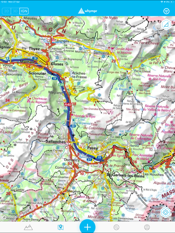
Access a collection of topographic maps, including IGN, SwissTopo, USGS and ten others, including the Whympr outdoor map covering the world. Visualize slope inclinations for thorough preparation.
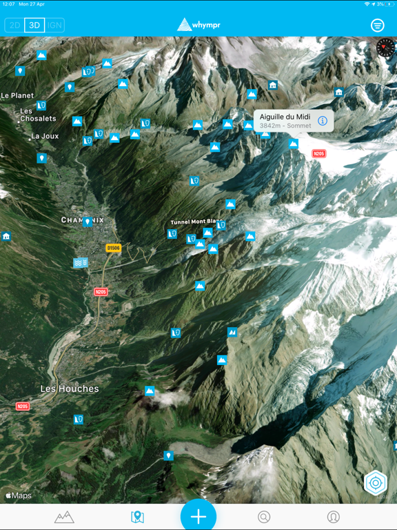
Access the 3D view and visualize different map backgrounds in 3D.
Download your routes for offline viewing, even in the most remote locations.
Access mountain weather, in partnership with Meteoblue, to know past conditions and forecasts, including freezing levels and sunlight hours.
Access daily updated avalanche reports from French, Swiss, and American official institutions.
Join a community of over 200,000 users who share their outings, helping you keep an eye on recent terrain conditions.
With the "Peak Viewer" augmented reality tool, discover the names, altitude, and distance in real-time of the peaks around you.
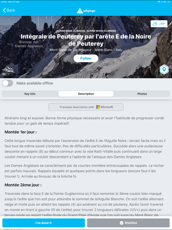
Check out Pro Topos written by professionals for climbing, ski touring, mountaineering, and hiking.
Activate the "sensitive zone" filter to avoid protected areas and contribute to the preservation of flora and fauna.
Add geolocated pictures to the map and comment on each outing to immortalize your experiences.
Share your adventures with the Whympr users and on your social networks to inspire other enthusiasts.
Create your outings to keep a record of your adventures, access your logbook, visualize your activities on a map, and find all your outing statistics in your dashboard.
Download the base app for free and try the Premium version for free for 7 days. Subscribe for €24.99/year afterward and enjoy exclusive features, including topographic maps, offline mode, advanced route filter, detailed weather conditions, GPS track recording, track creation with elevation and distance calculation, GPX import, and much more.